

Supporting Local News

Galway City’s big road that was once the King’s Highway
Published:
-

-
Author: Our Reporter
~ 9 minutes read
From this week's Galway City Tribune

Bohermore was the main route in and out of Galway City as far back as medieval times – but, as historian William Henry reveals in this week’s reflections on old Galway, its darkest days were in famine times.
The name Bohermore is made up of two Irish words, Bóthar, or road – which in turn derives from ‘bo’ meaning cow – and ‘Mor’ indicating ‘Big’, and it can trace its history back to the ancient roadway or track that existed long before the Normans arrived in the thirteenth century.
In around 908 AD, Cormac MacCuileannáin (King of Munster) defined ‘bóthar’ as a road wide enough to fit two cows ‘length-ways’ across a track. Bohermore occupies a natural ridge which long before human intervention, was delimited by Loch Atalia to the south and the Terryland River (Sandy) to the north. The ridge sloped into a natural valley as far as present-day Prospect Hill and then swept down to where the city lies today.
Most of College Road also occupied a natural ridge sweeping down to Loch Atalia on one side and the old ‘Meadle River’ (or stream) on the other. The river could be seen up to the time of the Forster Court housing development. The Meadle was then diverted into an underground culvert, and soon disappeared from sight. It was in reality a small, narrow freshwater stream running from the base of the hill now occupied by the New Cemetery. It flowed through the valley that existed between Bohermore and College Road, and into the River Corrib estuary.
The earliest reference so far established for Bohermore is from the Blake Family Records, dated 1573. This was referencing a mortgage on a field extended by John Blake to Walter Blake that year. The record stated that the field called, ‘Gort-i-boher’ and was situated on the right of the ‘Great Lane’ or Bohermore as one left the city. The Blake records mention the area again in 1602 in a similar transaction between the sons of the aforementioned men.
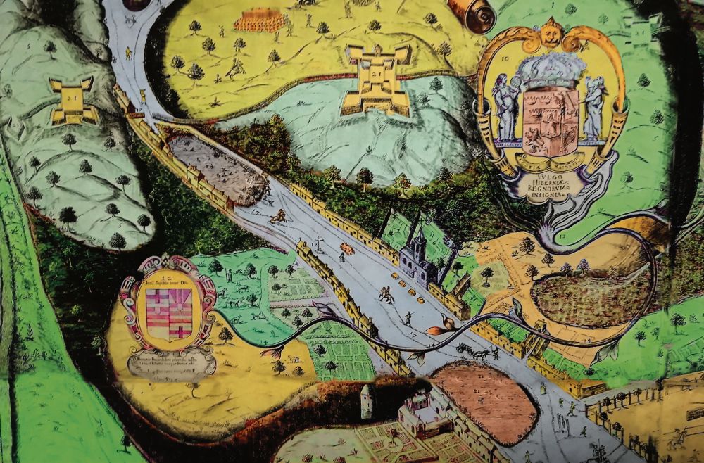
Bohermore was well established as the main road into the city by the medieval period as can be seen on the 1651 Pictorial Map of Galway. The road is indicated as running from the present-day Eyre Square to Cemetery Cross. The map shows a large pond called the Linn Mór or ‘Big Pool’ approximately where the terraces are sited today. A figure of a man presumably shooting ducks in the pond is also depicted. The road runs around the pond. The ground there was still marshy up to the late nineteenth century and was known locally as Garraglass. The map shows a cross on the top of the present-day Prospect Hill, it was known as ‘Ms Hynes monument’. The identity of this lady is unknown.
By 1651, Bohermore was evolving with buildings and houses being erected on both sides of the road. It was also called the King’s Highway, sometimes the Royal Highway or Great Lane. Another source mentions the name Mail Coach Road. However, Mail Coach Road was the name also used for College Road. There is no doubt that the King’s Highway was a very busy stretch of road leading into the city from earliest times with traders and farmers making their way to markets. Of course there were also visitors.
It is fair to say that this road would have witnessed many attacking armies over the centuries including Red Hugh O’Donnell in the winter of 1596. He was accompanied by Tibbot na Long Bourke, son of the famous Grace O’Malley (Granuaile). They were looking for supplies for their army. When Oliver Og French, Mayor of Galway, refused them assistance, they began setting fire to some houses along Bohermore, which caused a lot of damage to the suburbs.
The Cromwellians arrived in 1651 and the Williamites in 1691 and Bohermore witnessef a lot of military activity throughout this period. A large Cromwellian campaign fort was erected on the site of the later New Cemetery during the 1651-52 siege of Galway. This was connected to another two forts, one near Moneenageisha and the other called Boilingbrook Fort, the remains of which can still be seen just off the Sean Mulvoy Road. There was a gallows located near the modern day Cemetery Cross, some say on the old Sandy Road. It was referred to as the ‘Auld Gallows Road’ up to the nineteenth century.
Regardless of the names mentioned above, the road and area was definitely being referred to as Bohermore by the nineteenth century. There was a neat row of houses on each side of the road by this period. It was reported that a number of cabins in Bohermore benefited from the demise of Terryland Castle. Some of the dressed stone was taken from the castle and reused in Bohermore cabins during the nineteenth century. Many of the ‘cabins’ were thatched single-story houses.
In many cases, people tilled the land behind their houses giving some degree of self-sufficiency. In 1812, the population was recorded as 2,044 people living there. It seems that 378 houses were being occupied by 432 families.
However, similar to many other areas, the mid-nineteenth century became the darkest in the history of Bohermore. The area suffered untold horrors during the years of the Great Famine 1845-50. It was stated that at least five people perished every day in the ‘small parish of Bohermore, on the outskirts of the old town of Galway’.
Fr Bartholomew Roche, PP, told the relief committee that his parishioners were trying to survive on nettles and other wild plants. He had made one hundred and thirty sick calls in the previous few weeks and in one house alone, he had to anoint four members of the same family. The dreaded fever and dysentery that had broken out was taking its toll in lives and sickness. In many cases there was no person available to give those suffering from fever a drink of cold water to ease their suffering.
In February 1849, Fr M.A. Kavanagh, the parish curate wrote of the appalling living conditions of the people in Bohermore. He said that he visited five ‘sick cases’ in the locality on one wet and windy day. Upon entering the first house, he found himself standing in a pool of water as the roof was leaking badly and damaged in a number of places. It was very cold and there was a constant ‘dull-sounding splash’ as rainwater from the roof dripped into the pool on the floor.
He called out to see it there was anyone still alive in the house. At first there was no reply, but moments time later; a woman of about thirty years of age appeared from another room, holding an infant in her arms. Upon seeing the priest, she begged for something to eat for her children as they were starving. They hadn’t eaten in two days.
The curate thinking that he was in the wrong house, explained that he was not there to visit her and mentioned the family who had sent for him. ‘They are here’, she replied, the woman was staying with this family.
At that moment, another woman entered the room; she was the daughter of the family and had been out begging for a candle to light for the priest when he arrived. She lit the candle in the inner room, and the light revealed two ‘living skeletons’.
They were her father and mother lying on beds of straw on the ‘watery floor’ in different corners of the room. There was no fire, no furniture, not as much as a utensil; it was difficult to believe that this man had once been a ‘well-to-do’ tradesman before the famine. After performing the last ‘rights’ on the family Fr Kavanagh left the house.
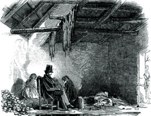
He made his second sick call to a family living nearby. He reported that this cabin was also dreadful, it was ‘scarcely sufficient to stable an ass’. He found the woman huddled in a corner of the room; she was very ill. In another room, he discovered her two daughters; the younger girl was shivering and weeping.
Their father was seated on a low stool between them. He was crouching over a single ‘coal of fire’. His face had every expression of sadness and misery. His son was out trying to collect cabbage leaves. Fr Kavanagh made a number of other sick calls that day and all the families were in a similar condition. However, he was totally shocked by his last call that day. This family were living in even worse conditions than any of the others.
He simply reported: “I fear to describe the misery I saw there. It is enough to say that the man died on the following day. I am sure before Heaven! He died of pure and absolute starvation . . . he was buried in the deep darkness of a wet and stormy night.”
The shocking torment for Fr Kavanagh can be seen from an extract in his diary: “Our town was never, never fuller of corn and flour and meal! It was all awaiting export.” These families were all fairly successful prior to the famine. However, four years of extreme hardship had been forced upon them by circumstances beyond their control. 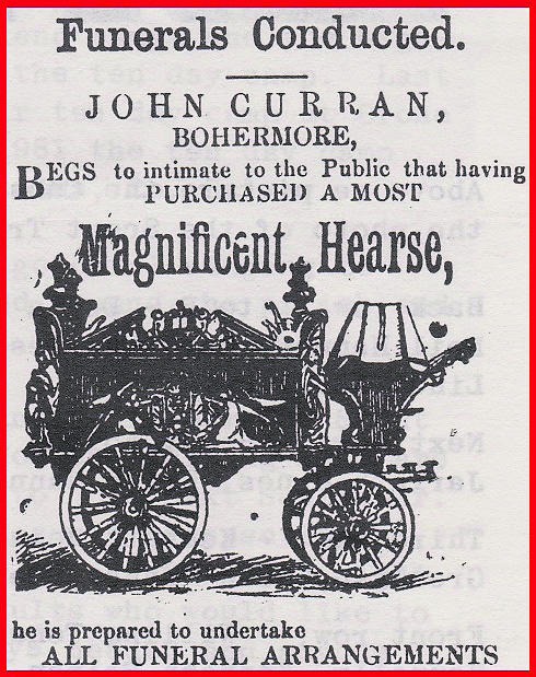
Fr Roche fought tirelessly throughout this period for social justice. He died on 18 April 1867, after he had contacted typhus while attending his people.
(Thanks to Patrick McPhilbin for photograph enhancement and colouring. If anyone has photographs or stories to share about Bohermore please contact williamhistory25@gmail.com
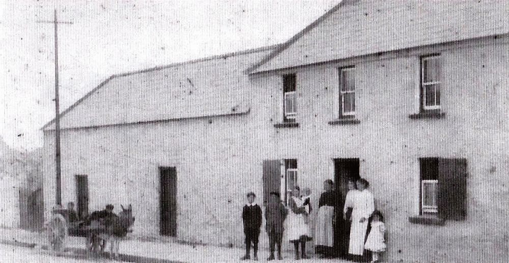
Main photo: late 19th century Bohermore.
More like this:
Clifden RNLI rescue family of six including six month old baby
A family of six were rescued by the Clifden RNLI last night including a three month old baby. The...

Galway TD claims Irish Water has “no interest” in towns and villages crying out for wastewater infrastructure
Irish Water has no interest in towns and villages which are crying out for wastewater infrastruct...
Refusal for significant housing development in Moycullen
Planning permission has been refused for a significant housing expansion in Moycullen. Solemia Li...

Into Unknown Worlds with Cois Cladaigh
Cois Cladaigh choir will present their final concert of the current season this Saturday night at...

City festival aims to show how families can drop that second car
It’s two years since Reg Turner got rid of his family’s second car and bought a cargo bike – and ...

Duffy does it again as he takes Shanghai by storm
GALWAY’S Michael Duffy continues in flying form on the Longines Global Champions Tour and the Mia...

Tumbling Paddies kick off An Púcán’s 10th anniversary celebrations
The Tumbling Paddies come to Galway City on Thursday, June 6, to celebrate 10 years of An Púcán, ...
Knocknacarra primary care centre will include a new hub for older people
A new primary care centre to serve the population of Knocknacarra and Salthill has been granted p...

Galway United hope to be at their most Dangerous best for Connacht derby
The Michael Jackson tunes pumped out of the speakers in the away dressing room in Dalymount Park ...